
OKUND, UTTARAKHAND, INDIA -Â We made the crossing at night from Chamoli, reaching this Himalayan foothill town after dark. The innkeeper, anxious for guests in a travel economy that came to a standstill in mid-June, cooked dal and nan bread for dinner and then showed us to a room that was unlit and unheated.
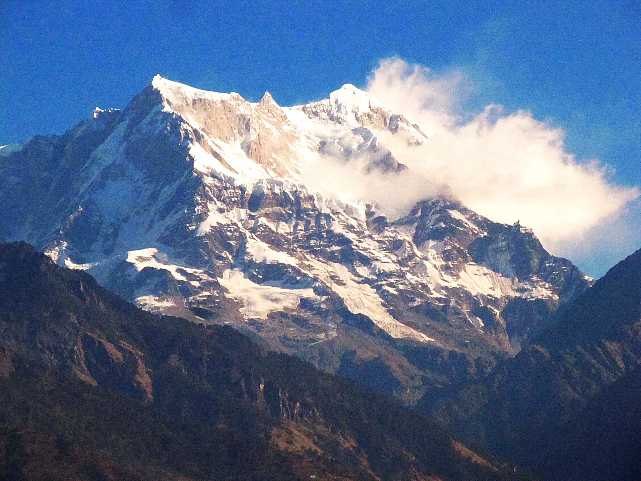
It didn’t matter. Thick blankets kept us warm. And at dawn we awoke to strong black coffee and the sun lighting the 21,000-foot Sumaru summit, turning the rock and snow from pink to orange to white. The lower slopes, terraced by generations, dove to the fast-moving Mandakani River. The current poured over gravel and boulders, the sound of it rising out of the tight valley like a beast’s heavy breathing.
For five long days I traversed this region of the Himalayas in the company of Dhruv Malhotra, a young New Delhi-based photographer, and Vinod, a professional driver raised in the hills. I’d come to understand the consequences of a flood in June that trapped and killed 30,000, maybe 40,000 Hindu pilgrims during days of terror.
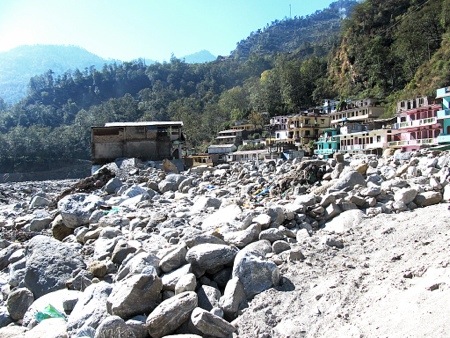
Steep mountains. Fast moving water. Active towns are the principle metaphors of the Himalayas. So is danger. This is an unforgiving landscape. On June 16 and June 17 the mountains unleashed such fury that four towns on two rivers — the Mandakini and the Alaknanda – were washed away. Entire sides of mountains slid into rivers, and with them came whole sections of mountain highways. Dozens of one-way-in, one-way-out towns and several larger cities were cut off for weeks, supplied with food and fuel by the Indian army.
I’m back in India for a month, just as I was at this time in 2012. I’m here on assignment for Circle of Blue, and our partner, the Washington-based Wilson Center. Over the last three years we’ve collaborated on our Global Choke Point project to understand how nations are responding to the resource confrontation that now defines so much of our economy and our global condition — the rising demand for energy and food in an era of diminishing freshwater reserves.
Last year in Choke Point: India I reported on India’s cycle of risk involving surplus grain production in western states and rising coal production in the east. This year we want to dig deeper into India’s coal production and consumption cycle, its solar and wind sectors, and its ambitious hydro-electric development program.
It’s the latter that prompted this trip to the Himalayas, where India says it wants to build the bulk of the 292 new hydroelectric power projects that are either under construction or proposed. India already has 176 operating hydro projects that account for a bit less than 20 percent of the country’s electrical generating capacity. There are – or were – 15 operating projects in Uttarakhand before the flood. One was buried under boulders and rubble on the upper Alaknanda. Another was damaged by silt from the flood tide that poured into its powerhouse and fouled generating turbines.
A third dam under construction was seriously battered by the Mandakini’s flood waters and the boulders it pushed along at the speed of a livestock stampede. Reinforcement bars, bent like wind-whipped wheat, form a tangled thatch of steel at the base of two broken support columns. A fourth dam under construction higher up the river was completely pulverized and washed away.
Though I have plenty of questions about policy and dam design that I am answering this week in Delhi, it seems to me that what happened in June, and continues to unfold along the Mandakini and the Alaknanda rivers, has implications for more of Asia and the rest of the world. The Himalayas are viewed as a prime hydro-electric production region. Valleys are tight. Water is abundant. And rivers fall fast and with immense kinetic energy.
China also has a big hydro development program underway on the other side of these big, unstable, treacherous mountains. India and China see in hydro development an opportunity to diversify their electric production sector, reduce reliance on climate-changing coal, and develop cleaner energy sources. There are also job, technology, and durable economic benefits from building big dams and power stations.
Still, the consequences of dam building to fisheries and the landscape are important and measurable. Climate change is melting the Himalaya’s glaciers and producing more serious rain events. As developing nations push higher up in the Himalayas to build energy-producing projects, the mountains are pushing back. In June they pushed hard. A lot of people were killed. A dam disappeared. Another was buried. Two more were damaged.
By the end of this trip I’ll know more. Next year, in the new Choke Point: India project Circle of Blue and the Wilson Center will publish and post what we learned.
— Keith Schneider
4 thoughts on “Torrent of Water and Big Questions Pour From Matchless Peaks of India’s Himalayan Region”