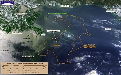
SkyTruth is an eight-year-old non-profit that uses satellite and aerial imagery to study landscapes. I’ve been keeping track of the Gulf Disaster with this organization’s state of the art remote sensing capabilities, all of it online and extremely useful. I’ve used SkyTruth’s work before in tracking big spills, and other disasters. Check it out.
— Keith Schneider